Chapter 19: An Old Mission Expands: Mapping and Engineer Strategic Intelligence
The extent and variety of construction and reconstruction assigned to engineer troops the world over created a demand for information about terrain, climate, natural resources, and man-made facilities. Although other arms and services applied Engineer strategic intelligence to their own purposes in many cases, such data served mainly to aid the Corps of Engineers itself. Almost precisely the opposite situation was true in the allied field of mapping. Provision of maps was a service performed by the Engineers primarily for others. The two major battle areas, one containing territories hardly explored, the other crowded with the works of civilized man, posed highly different but equally complicated tasks for Engineer mapping and intelligence agencies. In the Pacific the total area to be covered was greater and the sources of information were sparse. By contrast, a deceptive wealth of data was available for the smaller area of Europe and the Mediterranean. The fact that maps and other information about highly civilized regions become out of date more quickly than those of primitive ones, requiring constant revision to keep abreast of the changes, further complicated the situation.
The Beginning of an Engineer Intelligence Collection
The Engineers had no need to collect strategic intelligence data before 1939. Except for defense of its overseas territorial possessions, the United States had no obligation to commit its armed forces abroad. Hence there was no pressing reason for accumulating data about the character of soil, the currents of rivers, and the capacities of ports on a world-wide basis. During the prewar years, Engineer intelligence consisted of gathering information about foreign military engineering that might affect doctrine and techniques, and even this included for the most part just whatever happened to filter through G-2 of the War Department General Staff into OCE’s Intelligence Section. Concern over defense of the Western Hemisphere led to a broadening of interests. In the fall of 1940 the Intelligence Section began to prepare hemispheric studies which described terrain, natural and developed resources, and kindred matters of engineering interest in outlying areas of strategic importance. By the spring of 1941 research had extended into northwest Africa, Japan, and China as
well as to strategic islands in the Atlantic. Compiled by a few people from meager sources, these studies were preparatory outlines rather than detailed analyses.1
An all-out effort to improve the quality of future investigations began early in 1942. The Intelligence Branch approached this goal in two ways: by directly recruiting professional civilians and by enlisting assistance from other government agencies. Of the several existing organizations which might offer assistance, the U.S. Geological Survey, the Board of Engineers for Rivers and Harbors, and the Beach Erosion Board possessed knowledge and skills which were particularly needed. By summer 1942 each of these agencies had placed a group of its experts at the disposal of the Intelligence Branch. In peacetime these men conducted research for developing natural resources, improving inland waterways, and protecting beaches from erosion. In the course of this work they acquired much detailed and reliable technical information on such activities in foreign countries. Financed in large part by OCE, the Military Geology Section of the U.S. Geological Survey handled questions about water supply, construction materials, fuels, and weather. The Foreign Port Section of the Board of Engineers for Rivers and Harbors assembled statistical and descriptive data on foreign ports and terminals, including piers, unloading facilities, floating equipment, and warehouses. The Foreign Section of the Beach Erosion Board furnished information essential for amphibious operations. Although for years navies of the world had prepared hydrographic charts of deep-water areas, highly accurate inshore charts for the depths in which landing craft would operate had never before been required. However, from research already done abroad, one of the technical experts at the Beach Erosion Board, Dr. Martin A. Mason, could plot coastal terrain, showing configurations of beaches, inshore water depths, natural underwater obstacles, and other conditions. In August 1942, Mason induced Dr. William C. Krumbein, professor of geology at the University of Chicago and a Guggenheim Fellow, to collaborate in the study of beaches.
Valuable as the contributions of these agencies were, the city of Washington was limited in its resources. By contrast, the number of libraries in New York and the concentration there of firms with international connections provided an unexcelled reservoir of data on the engineering works of foreign countries. In May 1942, the Intelligence Branch took over a New York WPA translation project from the Soil Conservation Service, renaming it the Engineer Research Office (ERO) and placing it under the direction of Capt. John R. Vogler. Next door to ERO was the Engineering Societies Library, which subscribed to over 2,000 technical publications from forty different countries, and indexed every article. Just around the corner was the New York Public Library with its superb reference collection. At first ERO’s only job was to feed information to the Intelligence Branch in Washington, and this type of work, often involving translation, continued as a major function throughout the war. Beginning in the fall of 1942, Vogler gradually prepared to take on the more difficult assignment of carrying an investigation through all the stages of research and writing before its submission to Washington. The WPA project was liquidated in January 1943, some of its employees transferring to ERO’s civil
service payroll. Engineers, geologists, translators, and librarians had meanwhile been hired, bringing the staff at this time to a total of 106 civilians and 2 officers.2
Vogler and his executive officer, 1st Lt. Duane W. Ackerson, devised an assembly line system, dividing the work into research, bibliography, writing, and reproduction. One group combed the libraries of metropolitan New York to locate data on phases of engineering throughout the world. A staff of librarians cataloged and indexed this material according to subject, area, and author. Whenever the office started a new project or received requests for spot information, the library could furnish immediately a bibliography and a nucleus of source material. The research section then worked on the particular assignment and brought in books, periodicals, and documents to be photostated, translated, and filed for permanent reference. By the end of hostilities, the office had indexed over 140,000 entries by subject and country, 80,000 entries by author and title, and had collected great quantities of related reference materials. Normally the office worked on sixteen reports simultaneously, completing one each week and having the others in various stages along the assembly line. In June 1943 ERO submitted a four-volume report on French inland waterways, which was published as a finished Strategic Engineering Study. This marked the first of eighty such special studies prepared during the war.3
Other Strategic Engineering Studies, which covered the entire range of Engineer interests, were cooperative enterprises. A small unit in the Intelligence Branch in Washington contributed the chapters on railroads, roads, electric power, airfields, and other industrial facilities until ERO was able to assume this phase of the work in the summer of 1943. The U.S. Geological Survey assumed responsibility for the sections describing terrain and geology, the Beach Erosion Board for landing areas, and the Board of Engineers for Rivers and Harbors for ports and terminals.
Although intended primarily for the Corps of Engineers, Strategic Engineering Studies circulated widely throughout the armed forces. G-2 extracted terrain information. Naval Intelligence was particularly interested in the beach and port chapters, while the Army Air Forces used terrain studies to help locate enemy airfields, to determine what enemy facilities would make the best targets, and to choose suitable sites for its own bases. The Transportation Corps studied the engineering data on ports, roads, and bridges, while the Sanitary Corps of the Medical Department used material on water supply and sewerage. Civil Affairs and Military Government officers analyzed engineering reports in order to estimate their workloads in areas of varying degrees of industrialization. Overseas commanders supplemented these studies with other
information at hand to reach decisions on the movement of troops and supplies.4
The Beginning of an Engineer Map Collection
In sharp contrast to the Corps’ inexperience in collecting strategic engineer intelligence were its century-long mapping activities. Yet this traditional Engineer mission was also deeply affected by prewar concepts of defense. Emphasis before Pearl Harbor had been upon the development of equipment and techniques to exploit aerial photography. To the extent that such means could be applied no matter where the Army fought, this approach was altogether wise and logical. To the extent that the possibilities of the new techniques had been exaggerated, this approach invited disaster. Fortunately, by 1942 a good many realists had had their say. The catchy phrase, “The Army must map as it moves,” was no longer taken seriously. Too much depended upon uncontrollable factors—weather, enemy activity, skill of pilot and photographer, range and maneuverability of photographic aircraft, and the rate of the Army’s movement. Even during the maneuvers of 1940 and 1941, the main supply of maps had to be prepared well ahead of time. Topographic field units supplemented the major mapping preparations for these exercises by overprinting last-minute revisions, reproducing additional copies, and arranging for their distribution. From his observations, Colonel Loper, the chief of OCE’s Intelligence Branch, concluded that the most practical solution to mapping vast potential combat areas would be a judicious combination of aerial surveys with map sources already in existence. Many areas of the world had already been mapped at tactical scales. Aerial photography would be used for revising these maps and filling gaps in coverage. Compilation of large-scale battle maps would still be required for key points of attack or defense. Close cooperation between the Air Forces and Engineers was therefore still indispensable to success.5
Indispensable also was a systematic collection of maps. When war came, the War Department had an accumulation, rather than a systematic collection, of foreign maps. The War Department Map Collection had been established before World War I when G-2 consolidated the holdings of various intelligence units. The Corps received custody of this collection in 1938, turning it over to the Engineer Reproduction Plant, which was located in Washington. Up to this time, the Engineer Reproduction Plant had sustained a precarious existence. Although set up to perform lithographic work for the War Department, it operated without direct appropriations. In order to retain a nucleus of about 100 trained employees, it undertook lithographic work on a repay basis for other federal agencies. The plant had equipment to reproduce multicolored maps of whole countries or continents, showing such features as natural resources, railroads, highways, cities, and industrial areas. Its presses were much larger than those assigned to topographic units. Primarily a print shop, the plant also employed cartographic draftsmen, and, beginning in 1938, supervised a WPA project
which was compiling a large-scale map of the United States.
During 1940 and 1941, while Maj. Albert G. Matthews was in charge, the Engineer Reproduction Plant gradually relinquished job printing entirely in order to concentrate on maps of Army camps and maneuver areas. To assist in this work the plant organized fourteen more WPA offices. Matthews broke down complicated jobs normally performed by experts into tasks simple enough for novices to handle. A relatively few experts could then supervise the work on an assembly-line basis. Matthews also instituted a system of training understudies for higher positions so that in an emergency the plant could expand readily under experienced and responsible leadership.6
By hiring additional employees and acquiring new and faster presses the plant increased production, but its building was too small for efficient use of staff and equipment. Early in 1941 the Engineers received authorization to erect a new building on the outskirts of Washington. Ready for occupancy by spring of the following year, this facility was a black-out type of structure that permitted uninterrupted operations in event of an air raid, was carefully designed to facilitate the flow of work from one department to another, and was air-conditioned to prevent changes in temperature and humidity from affecting the dimensions of map paper. Upon moving into this modern establishment, the Engineer Reproduction Plant became the Army Map Service (AMS), a name which more aptly described its broadened responsibilities. Experience in organizing partly skilled workers in the WPA days proved beneficial during the war years. AMS persuaded some women’s colleges to offer an elementary course in cartography which prepared students for jobs at the main plant and at field offices. AMS then trained them for library work, map research, map design, translation, computation, compilation, photomapping, drafting, and editing. By the middle of 1943 there were 300 more women than men among the 3,500 employed by the organization. Whereas the Engineer Reproduction Plant had been essentially a lithographic shop, AMS could execute a wide variety of steps in the mapping process. It lacked, however, the means to compile original maps from aerial photography, for it had no multiplex projectors until 1945.7
The mainstay for multiplex work was the base topographic battalion, but in an emergency other federal agencies stood ready to assume part of the load. Between the two world wars, about twenty federal agencies outside the War Department carried out some mapping in connection with their principal activities. Absence of coordination among them produced a wide range
Women compiling foreign map information, Army Map Service, January 1943. At right is Lt. Col. Frederick W. Mast, Executive Officer
of specifications and scales. During the same period, allotments for military mapping averaged $44,000 a year, limiting this work to training areas and such projects as could be arranged through agreements with the U.S. Geological Survey and the WPA. For some years the Geological Survey, in preparing basic topographic maps throughout the United States, had given priority to areas designated by the Chief of Engineers as of military importance. To avoid duplication of effort, the Engineers in turn coordinated their mapping projects with those of the Geological Survey. But until 1941 budgets were too small to push this domestic mapping program. At this time, Congress began to view an attack on the United States as a possibility and approved a three-year War Department project for mapping, at tactical scales, a strip of territory 200 miles in depth along the coasts and borders of the United States. To accomplish this work, Loper enlisted the aid of the U.S. Coast and Geodetic Survey, the Tennessee Valley Authority, and the U.S. Forest Service as well as the U.S. Geological Survey, all of which were well qualified to handle mapping assignments. The finished maps of the Geological Survey were based upon the triangulation network furnished by the Coast and Geodetic Survey which also prepared coastal and aeronautical charts. In
need of highly detailed topographic information for drainage basin studies, the TVA had mapped the Tennessee Valley watershed before starting to develop the resources of that region. In managing 160 national forests, the Forest Service had to map roads and trails in an area twice the size of California. The heads of these agencies agreed in October 1941 to mobilize their facilities and about 3,000 employees for the War Department’s domestic mapping program. The foundation was thus laid for a unity of effort that could be directed, if necessary, to the compilation and revision of foreign maps.8
This pooling of mapping resources, combined with the modern facilities of AMS, placed the Engineers in a position to handle whatever maps and map sources came their way. Most of the maps that had been transferred to the War Department Map Collection and most of those received in the years immediately following came from military attaches and other G-2 officers. For want of money, many sets of maps were incomplete or obsolete. From British sources the Engineers strengthened the foreign map collection. With centuries of experience in international affairs, the British had developed map holdings for all parts of the world. On 26 December 1940, Maj. Michael Collins of the Geographical Section, General Staff (GSGS), the British War Office mapping organization, proposed exchanging data. On getting the approval of G-2, Loper sent representatives to discuss coordination of the map libraries of the two nations. In August 1941 Collins, in turn, visited OCE. That same month maps arrived from England. They included coverage for Iceland where American forces had recently landed.9
Once the nation was committed to war on foreign soil, Congress lifted budgetary restrictions that formerly had applied to the purchase of foreign maps. Early in 1942, G-2 and the Intelligence Branch, OCE, started a vigorous drive to increase the map collection. Through the cooperation of the British Dominions and colonial governments, American military attaches were able to send some maps home. But the days when one could order maps from abroad were practically over because of censorship imposed by war. To exploit local sources of information, intelligence agencies scoured the holdings of libraries throughout the country and set up map collection offices in seaport towns. Much valuable geographical information was acquired from
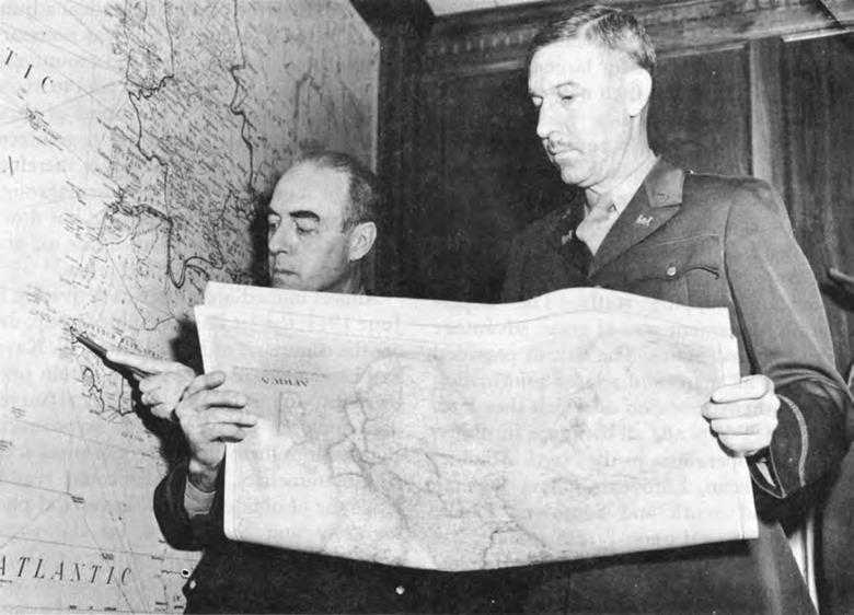
Col. Herbert B. Loper, Chief, Intelligence Branch, OCE (right), planning a map project with Col. W. A. Johnson, Commanding Officer, Army Map Service, January 1943
sea captains, former tourists, shipping companies, and firms engaged in foreign trade.10
The GSGS of the British War Office nonetheless remained by far the most important source. In the spring of 1942, Col. Martin Hotine, its director, came to Washington to confer with Loper. The British were up to their necks in work and had lost part of their mapping plant in the London blitz. The Royal Air Force was not equipped to provide precision photography. The Americans lacked an adequate collection of existing maps. On 12 May representatives of the two countries signed what was commonly known as the Loper-Hotine Agreement, the cornerstone of the wartime mapping effort. It divided responsibilities for new mapping along geographical lines. The United States accepted responsibility for preparing all new maps for the Western Hemisphere, Australia, New Zealand, Japan, the Netherlands Indies, and islands scattered throughout the whole Pacific. With the aid of aerial photography furnished by the United States, Great Britain would supply maps
for other areas—northwest Europe, west and northwest Africa, Indochina, Malaya, and Thailand. Except for large-scale maps of the United States, each nation agreed to furnish source materials and reference copies of all new maps automatically and to supply copies of existing maps on special request. To coordinate map supply overseas, OCE would assign representatives to serve with British mapping agencies, while GSGS would likewise maintain liaison with American mapping staffs. The Loper-Hotine Agreement was of great advantage to the United States. The British provided copies of all maps and related information then in their possession or which they later acquired. Practically all the maps furnished for initial operations in the North Atlantic, Mediterranean, European, China-Burma-India, and South and Southwest Pacific areas were based upon British sources. But even British sources were far from complete and far from perfect. For full and up-to-date coverage, mapping agencies at home and overseas depended upon the AAF to furnish aerial photography.11
The Conflict Over Aerial Photography
The AAF’s photographic groups which were to perform mapping missions for the Corps of Engineers flew fighter planes that had been converted to photographic aircraft (F-4’s and F-5’s). The speed and altitude of these planes were satisfactory for this purpose. Their range was sufficient for Europe, although not for the Pacific. Otherwise these planes did not meet Engineer specifications. The F-4 and F-5 were single seaters. The Engineers desired a two or three-place plane to carry either a photo-navigator or else a photographer and navigator in addition to the pilot, with the photographer to keep the camera in vertical adjustment. In the F-4 and F-5 it was necessary to install the camera in a fixed mount and to depend upon the skill of the pilot to maintain a given position. The cabins of these planes were neither heated nor pressurized. The time spent at high altitudes therefore had to be short. The AAF proposed, through a new system of photography, to cut down on the amount of time spent in the air and to obviate the need for skilled crews.12
Almost immediately after its activation in June 1941, the 1st Photographic Group, under the command of Maj. Minton W. Kaye, had been assigned to Alaska to obtain photography which the U.S. Geological Survey undertook to convert into aeronautical charts. Since these charts were of small scale and planimetric, draftsmen could readily make use of oblique as well as vertical photography and thus speed up the work. Kaye’s Photographic Group began, therefore, to mount one wide-angle camera vertically between two other wide-angle cameras tilted in opposite directions. This trimetrogon mount took one vertical and two high oblique photographs which pictured an area from horizon to horizon. The trimetrogon mount enabled pilots to space
their flight lines twenty-five miles apart as compared with the four-mile spacing specified by the Engineers for vertical, wide-angle photography. Because a few photographs covered such a large area, it was easy to determine tip and tilt and the pilot could vary his altitude and directions considerably.13
Having shifted to the T-5 wide-angle camera to avoid troublesome oblique photography and thus speed up the compilation process, the Corps of Engineers did not welcome the trimetrogon mount. It still preferred the T-5, even though, with its elaborate system for recording tip and tilt, it had proved difficult to produce and to keep in adjustment. While waiting for the delivery of acceptable T-5’s (which never came), the AAF installed wide-angle lenses in older, single-chamber cameras, and the Engineers changed over to wide-angle multiplex projectors. Just as the 1st Photographic Group was beginning its experiments with the trimetrogon mount in Alaska, the Engineer Detachment at Wright Field, working from vertical wide-angle photography, mapped the vicinity of Dayton, Ohio. Results showed great improvement over previous tests and approached the specifications for battle maps desired by the Field Artillery. On the basis of output per man, it was estimated that a topographic battalion could complete the first map sheets in six days and could thereafter maintain a production rate of 600 square miles daily. In other words, by the use of wide-angle photography, under optimum conditions, a topographic battalion could attain greater accuracy in about one sixth the time previously required for making the battle map.14
The Engineers feared that the trimetrogon mount, with its obvious advantages to the AAF, would deprive them of means for compiling precise, large-scale maps. Trimetrogon photography could not be applied to all mapping needs of the ground forces because this type of photography produced some distortions which no known instrument could correct. Reduction in scale outward from the center of any picture makes it progressively difficult to determine the position and to identify certain features of the terrain. These difficulties were multiplied in the oblique photographs because features relatively close to the camera tend to mask those farther away. The larger the scale of the map drafted from such photography, the greater the error. Battle maps compiled from trimetrogon photography would be inaccurate to the point of uselessness. For the preparation of tactical maps of undeveloped areas, trimetrogon photography had its place, however. Draftsmen could hold errors of position to acceptable limits and could define bodies of water and other natural features on maps of this scale. But since innumerable errors were inevitable in distinguishing such details as highways and railroads, trimetrogon
photography could not be applied, even to tactical maps, in regions such as Europe.
Within the Corps of Engineers opinions differed as to the position to be taken on the AAF development. The Engineer detachment at Wright Field, emphasizing the threat to precise mapping, urged continued concentration upon the perfection of compilation from vertical wide-angle photography. But Dau, heretofore a strong advocate of this type of photography, faced up to the fact that topographers had better prepare to make the most of whatever the AAF furnished. From the Engineer Board, Dau advised the Wright Field detachment to study equipment and techniques for applying the new method. The board selected several of the devices used by the Geological Survey for plotting obliques, and the techniques of mapping from trimetrogon photography were made an integral part of the training of topographic units.15 This training was superimposed upon, rather than substituted for, instruction in the standard methods of compilation from vertical photography. In a memorandum written to the War Department in September 1942, Loper cited the limitations of the AAF’s method and warned against “over optimistic conclusions” as to its value. The AAF was to take sharp issue with the Engineers’ estimate of the worth of trimetrogon photography, but not until after experiences overseas had added fuel to the quarrel.16
In 1942, while MacArthur was organizing the Southwest Pacific Area to defend Australia from invasion, the Intelligence Branch collected a nucleus of maps for his current and future needs. In addition to maps of British and Dutch origin, the branch sent him aerial photography and information acquired from oil companies and other private firms. AMS prepared small-scale maps for operational planning and forwarded bulk stocks to topographic units which arrived in Australia during the summer of 1942. Much of this coverage was poor to start with and difficult to improve for want of aerial photography. Tropical storms, haze, and great distances from air bases to photographic objectives impeded operations. The B-24, converted to the F-7, which became available in 1943, had the range the F-4’s and F-5’s lacked, but made a ready target for enemy interception.
In order to secure maximum coverage with extremely limited facilities, mapping pilots in the Pacific usually depended upon trimetrogon camera equipment. At first engineer topographic units prepared only large-scale photomaps and medium-scale planimetric maps with form lines and rough contours. Later, through experience in working almost exclusively with trimetrogon photography, topographic units were able to convey more detail at larger scale. Taking the surrounding sea level as the basis for determining elevations, they could plot the topography of small islands. In 1943 the Engineer Board began to alter the multiplex to accommodate oblique photography and by the end of the year was able to plot 100-foot contours with the equipment. Although
this was still a long way from the degree of accuracy obtained by the use of the wide-angle vertical camera and standard multiplex sets, the trimetrogon system, with its wide coverage, spelled the difference between maps and no maps in this area where pilots, planes, and good photographic weather were at all times scarce. The Southwest Pacific had, moreover, much in common with Alaska, the first proving ground for trimetrogon photography, in that natural rather than cultural features predominated.17
The quarrel between the Air Forces and the Engineers over the type of photography to be furnished centered from first to last on the areas involved in the war against Germany. The spring 1942 decision to stage a cross-Channel invasion of Europe approximately a year thence earmarked the channel coast of France as a vital area for which large-scale maps would be required. Existing maps of this region were based upon old and inaccurate Napoleonic surveys, some of which had been “blown up” from 1:80,000 to 1:50,000 scale without appreciable correction. Shortly after evacuating Dunkerque, the British had set up what was known as the Benson Project for remapping the coast between Cherbourg and Calais to a depth of 60 miles at 1:25,000 scale. Operating from an airfield at Benson, the RAF had begun to take aerial photographs of this strip of land. Regrettably, Hotine informed G-2, the planes assigned to this mission were incapable of flying high enough to escape enemy interference for more than a brief period. The result was hundreds of hit-and-run sorties at varying altitudes and angles and a mass of unusable photography. Moreover, the British were unprepared to do photogrammetric work for they had no multiplex equipment.18 The Loper-Hotine Agreement accorded first priority to the channel area in providing for American assistance “where this is outside the capacity or equipment of Photographic Reconnaissance Units of the RAF.”19
On 13 May 1942, G-2 suggested practical arrangements to Marshall. Under the plan proposed, the AAF would convert four heavy bombers to photographic aircraft and furnish them with highly trained crews. One engineer photomapping company would proceed to England to assist the British in compiling maps by multiplex. Sufficient crews and specially equipped planes to form a complete mapping squadron and additional topographic units would augment this advance echelon as soon as possible in order to compile maps of other areas destined for offensive operations. In June, Maj. Herbert Milwit, who then commanded the 30th Engineer Topographic Battalion (GHQ), arrived in England to prepare for American participation in the Benson Project. Milwit did not minimize the difficulties to be faced in securing the precise vertical photography needed to make the assignment of American topographic units with their specialized
equipment worth while. He anticipated the necessity for fighter protection and the employment of diversionary tactics in order to safeguard the precious B-17’s and their crews. Yet he thought the job could somehow be done. The AAF disagreed: it would be impossible to fly on a given straight line at a set altitude in the face of heavy enemy opposition on the Continent.
The B-17’s were diverted to North Africa and, upon its arrival in England, the engineer photomapping company set aside its multiplex and went to work with the British in an attempt to make something out of the random photography available. Production of the entire force, including seven British companies, amounted to about 1,500 square miles of compilation a month. The engineer company alone could have doubled this output had wide-angle vertical photography been obtained. For the time being, however, these frustrations were submerged in the general effort to supply maps for the impending landings in North Africa.20
For the initial operations in this theater the British furnished sets of French maps dating from 1920 to 1939. The coast had been mapped at 1:50,000 scale, much of the remaining area at 1:100,000, and the entire theater from French Morocco through Tunisia at 1:200,000 and 1:500,000. The Intelligence Branch compiled an encyclopedic engineering report on North Africa in thirteen volumes. For this study ERO furnished extensive bibliographical and reference data which the staff in Washington utilized in writing three volumes on roads, railroads, airfields, electric power, and fuel. The Forest Service contributed a section on building materials. The Military Geology unit prepared two volumes of maps and tables which gave information about water supply, airfield sites, and road building materials. The Board of Engineers for Rivers and Harbors wrote detailed descriptions of ports and terminals, including facilities for unloading, repairing, and storing equipment. The Beach Erosion Board prepared maps and charts of strategic landing areas in French Morocco and Algeria, showing the depth of water to be encountered. In September, AMS printed fifty copies of this engineering report for the use of the Combined Chiefs of Staff, commanders of the expedition, and various planning and intelligence agencies. To meet additional demands during the campaign, a second printing was ordered in January 1943.21
The initial supply of maps and intelligence data provided the foundation upon which AAF photographic crews and Engineer topographic troops were to build. Adverse reports were not long in reaching the Intelligence Branch. There was the dramatic letter from an Armored Force commander:
On the eve of going into action I feel that it is absolutely necessary to invite your attention to the fact that this command is going in without adequate photographic coverage of the terrain over which it is going to operate. Certain Air Corps pilots have done very valiant work in securing the photographs which we have, and all credit should be due them. However, the coverage is not only incomplete, but the copies furnished the troops are insufficient.22
There was the more prosaic but weightier judgment from Lt. Gen. Dwight D. Eisenhower: AAF planes and crews were unequal to the job.
Armed with such reports from overseas, Loper felt justified in pressing the AAF to conform to Engineer standards of mapping photography. Pitted against Loper was Kaye who had risen from command of the 1st Photographic Group to Director of Photography, AAF. Kaye claimed the Engineers had failed to exploit fully the possibilities of trimetrogon photography and asserted that the need for accurate large-scale maps had been greatly exaggerated:
Modern offensive warfare, utilizing closely coordinated operations of aircraft with fast moving mechanized ground units and the striking power of aircraft on vital objectives far within enemy territory has completely revolutionized tactical map and chart requirements. ... Trimetrogon photography and compilation is not the answer to all mapping problems, but, while developed primarily for small scale charts, the method has certain advantages which should not be overlooked when photography must be accomplished in combat areas and maps prepared rapidly for offensive operations.23
G-2 would accept none of Kaye’s arguments. Tests conducted by the Corps of Engineers were conclusive. Mobile forces, being extremely sensitive to terrain, had to have precise information. Any improvements in equipment or techniques that would render trimetrogon photography adaptable to precise mapping would be welcomed, but until research agencies made such improvements available, the AAF had to conform to Engineer specifications. The AAF could meet those specifications if it developed a special plane capable of sustained operations beyond the normal effective ceiling of enemy fighter aircraft. On 25 January 1943, the War Department directed the AAF to develop such a plane.
Now that he had an unequivocal endorsement of Engineer standards, Loper pushed his advantage in an effort to insure enforcement. On 25 February, Reybold reiterated his recommendation for centralized command of mapping activities. As finally worked out by G-2 in April, the proposed reorganization took its model from the British. The plan called for the creation, under the supervision of G-2, of a topographic survey directorate to control the organization, training, and employment of Air Forces and Engineer mapping and charting personnel; provide theater facilities for production and distribution of maps and charts; and coordinate supplies with the Navy, with civilian agencies, and with American Allies.24
Up to this time it had been extremely difficult to get the AAF to commit itself on future plans. There had been no response to the War Department’s directive to develop a special plane. Comment on an Engineer statement of photographic requirements in Europe was not forthcoming for almost two months, and then only after OPD had sought AAF’s reaction a second time. On 4 May, however, Brig. Gen. Thomas J. Hanley,Jr., Deputy Chief of Air Staff, issued two statements of policy. The first, addressed to key AAF officers, apparently signaled complete capitulation to the Engineers’ demands. “Starting at once,” Hanley ordered, “pictures required by the
Ground Forces and the Engineers will be made according to the requirements for military mapping designated by the Engineers.” It was Hanley’s expressed hope that his order would put a stop to “the bickering” between the services, but his second memorandum, to G-2, contained the seeds of further discord.25 The AAF opposed the development of a special photographic plane because in the two or three years it would take to get one into production the enemy would have matched it with fighter craft. The War Department’s requirement could best be met by the expected transfer of a number of British Mosquito planes which could carry a cameraman. With or without Mosquito planes the AAF stood ready to obtain any photography deemed necessary. Hanley emphasized, however, that responsibility for determining necessity rested with the War Department and with theater commanders. The War Department should state the mapping requirements for each theater, indicating at the same time the priority to be assigned this task in relation to other military missions.
That the Director of Photography, AAF, had been banking heavily on a low priority for mapping missions was clear from counsel he made to the two ranking Air Forces officers in the ETO within four days of Hanley’s memoranda. While admitting that an invasion force would find it “extremely costly” to operate with the antiquated maps on hand, Kaye nevertheless exhorted the Air Forces generals to “steadfastly recommend against the performance” of the photographic missions requested by the Engineers, encouraging the theater commander to “balance the extreme cost of performing this job against the absolute military requirement for this type of map.” A “major effort” involving 40 or 50 B-17’s, plus fighter protection and bombing diversions, was indicated. Yet the losses were bound to be heavy. Kaye asserted, moreover, that the Engineers would find it impossible to make timely use of the photography if they had it. The size of the area was “tremendous.” Inexperienced in multiplex work, topographic organizations would become “absolutely snarled in compilation.” Photographic aviation in the ETO must be expanded, not for actual mapping purposes, but in order to supply an invasion force with large-scale photomaps as the tactical situation demanded.26
A copy of Kaye’s memorandum arrived in Washington at a time when the reorganization scheme seemed about to die for want of support. Not only was the AAF cold toward it, but other agencies involved had argued that G-2 had sufficient authority already and had called attention to the AAF’s promise to do better.27 In the light of the Kaye recommendations the Engineers felt justified in inquiring whether or not the AAF was playing a double game.
Kaye had greatly exaggerated the task, Robins wrote AAF. Coverage to be supplied amounted to but one eighth the estimate furnished. Specifications were far less rigid than pictured. Kaye was ignorant of the capabilities of engineer topographic units. Far from being inexperienced in multiplex work, these troops could compile maps by this method at the rate of 7,000 square miles per month. If this production proved insufficient, the Chief of Engineers would tap the services of skilled civilian
agencies. Did Kaye’s memorandum represent official or personal opinion? Robins challenged the AAF to repudiate it.
The AAF endorsed Kaye’s estimate of the current situation in the theater. It was impossible to obtain mapping photography at that time since fighter protection could not be provided for bombers and since F-5’s were presumably incapable of meeting specifications. But taken as a whole Kaye’s ideas were no longer deemed sound around AAF headquarters. The poor performance of all types of reconnaissance units in North Africa, the growing recognition of the importance of photography in strategic bombing, no less than outside pressure, convinced AAF policy makers that a major change was in order. Development of a special plane would begin at once, G-2 was assured on 1 June. Pending the receipt of the two-place, highly navigable mosquito planes, the F-5 might be used to some advantage. For long-range operations in the Pacific some of the new B-29’s were to be provided with camera installations. Experienced reconnaissance officers were subjecting the training program to a thorough shake-up.28 In AAF headquarters Kaye was replaced by Col. James G. Hall, whom the Engineers considered sympathetic with their objectives even though he could not always accede to their wishes.
On 22 June 1943, the AAF flew its first mapping mission in the ETO in F-5 planes. From then on there were many such missions, both in northern and southern Europe.29 Topographers reported that the photography, although “not perfect” had “improved enormously.” Some of it was “good.” Loper was incredulous. “These are strange words around Washington,” he remarked, “and we hope we won’t wake up to find it was all a dream.”30
To deliver acceptable photography with F-5 airplanes demanded more skill on the part of the pilot than if there had been room for a photo-navigator. The AAF assured the requisite skill by following through in its plans to improve the training of reconnaissance units, including those assigned to mapping photography. In the end everything hung on this. Mosquito planes were not transferred in any numbers. The special photographic airplane never got into production. Most photographic missions were flown in F-4’s and F-5’s by a small group of dedicated Air Forces officers, among whom Col. Karl L. Polifka rendered outstanding service, first in the Southwest Pacific and later in the Mediterranean theater.31
Convinced that the AAF had embarked on a comprehensive program to improve its photographic services G-2 suspended action on the reorganization scheme. Quickly Loper turned his attention toward having a comprehensive mapping directive sent out to the theaters.32 On 18 August 1943, the War Department issued such a directive. It was not quite what Loper desired. He had recommended the establishment, in the theaters, of a staff agency endowed with power to direct the entire mapping effort. Instead of making such a provision, the War Department deferred to the AAF viewpoint that mapping was the direct responsibility of the theater commander, and that having knowledge of over-all demands, he “must weigh the relative importance of mapping
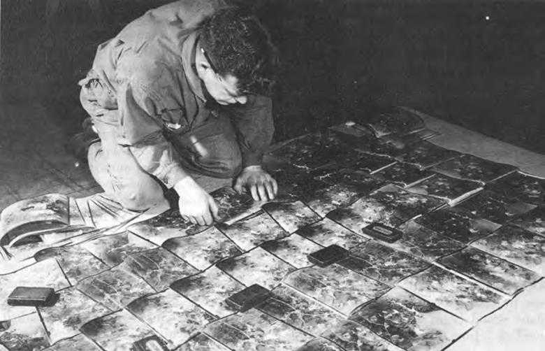
Laying out aerial photographs to check sequence. Soldier is a member of an Engineer topographic battalion stationed in England
photography and indicate positive priorities.” But the whole tenor of the memorandum emphasized the importance of accurate maps and made a sharp distinction between mapping photography and trimetrogon photography. Accurate maps could not be produced overnight. Photography must be obtained well in advance of operations. Map supply must, therefore, be included in the very earliest stages of planning. By the fall of 1943 the Engineers, despite the loss of a few battles, had won a war.33
Adjustments to Mounting Demands
The growing strength of the Allied offensive, together with the receipt of greater quantities of aerial photographs, put Engineer topographic organizations to a severe test. Topographic units had been devised to meet average requirements of corps, army, and GHQ. Experience overseas demonstrated the need for flexibility in organization and equipment. Basic map sources might be relatively plentiful for one theater, extremely scarce for another. Variations in the availability of aerial photographs were also to be expected. During the North African campaign two provisional engineer map depot detachments proved their utility. Similar detachments, or teams as they came to be designated, were organized in 1943 under the Engineer Service Organization, T/O 5-500, which contained numerous
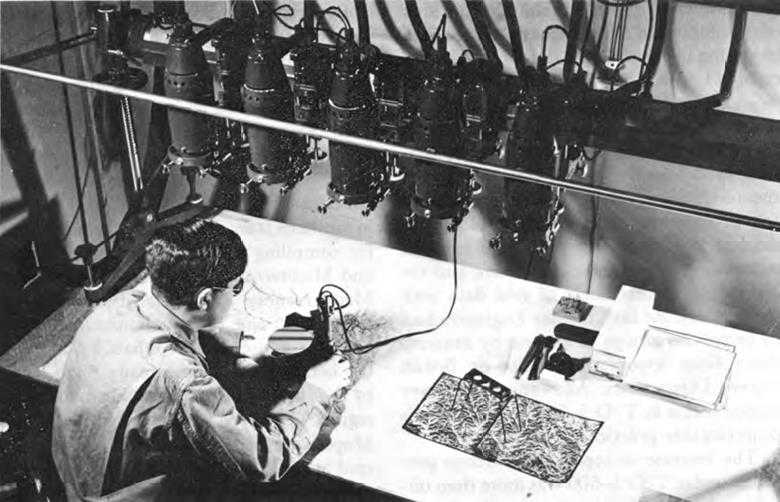
Soldier using multiplex to determine the third dimension of aerial photography, England, January 1943
cellular units favored by Loper as being particularly applicable to mapping. Besides the map depot teams, T/O 5-500 made provision for survey teams, survey liaison teams, reproduction teams, photomapping teams, and model-making teams. These teams would either supplement the larger topographic organizations or would be combined in ways that permitted concentrating on whatever phase of mapping was most urgent.34 To increase the adaptability of topographic units, the Intelligence Division assigned special equipment or encouraged variations from T/O’s which, according to Loper, “frequently meant the difference between success and failure in accomplishing missions.”35
The model-making teams were something new, an outgrowth of investigations into camouflage. A detachment of model-makers had been trained at Belvoir to make three-dimensional plaster-of-Paris models of military and industrial installations in order to devise ways to conceal the real thing from the enemy. For the North African and Sicilian landings this group prepared terrain models of ports and beaches, enabling busy task force commanders to grasp the situation at a glance. The models came in three-by-five-foot sections and although very heavy, they were flown to the Sicilian task force in
the summer of 1943.36 “I shudder to think of the amount of air transport we have used in getting the models into the theater,” commented Loper, who at the time had difficulty in securing priorities for sending copies of maps overseas by air. To save cargo space and otherwise reduce strains in transportation, model-making teams were sent to the theaters.37 Survey liaison teams filled a need felt at Engineer theater staff level for assistance in determining map requirements, supervising topographic battalions, and coordinating the exchange of grid data with the artillery. At first, theater Engineers had to improvise groups of experts by drawing them from topographic units or British Survey Directorates. Allowance for survey liaison teams in T/O 5-500 eliminated this objectionable practice.38
The increase in topographic troops provided under T/O 5-500 was more than offset by reductions of Engineer estimates for the 1944 Troop Basis. The Engineers had put in for five base battalions, nine army battalions, and eighteen corps companies. The General Staff, intent on cuts in manpower, proposed to eliminate two of the already existing four base battalions. In arguing against this action, Loper and Sturdevant pointed out that these units, equipped with the multiplex, were about to come into their own now that the AAF was beginning to deliver aerial photographs in quantity. The General Staff agreed to the retention of four base battalions, allowing the Engineers to choose other means for reducing personnel. New T/O’s which became effective toward the end of 1943 eliminated one of the survey companies from the base battalion, substituted a photomapping company for the survey company in the army battalion, and reduced the strength of the headquarters and service, and reproduction companies of both units. The reduction in military forces meant that the Intelligence Branch would have to utilize AMS and civilian mapping agencies to a greater extent on long-range projects.39
In September 1943, while GSGS and overseas topographic units were supplying maps for the immediate requirements of the American Fifth and British Eighth Armies in southern Italy, Loper made arrangements for compiling new maps of northern Italy and Mediterranean France. The surveys of Mediterranean France had been made between 1815 and 1855 with instruments and methods of questionable reliability. Many of the bench marks had already disappeared by the 1890’s when topographic maps of this region had been compiled at 1:80,000. Maps were better for northern Italy, covered at 1:50,000, but they had to be revised to improve accuracy of detail. During July and August 1943, the AAF had taken photographs of both areas, but the film was held in the theater until October. After at last receiving the film, Loper assigned northern Italy to AMS and southern France to the Fairchild Aerial Surveys, the U. S. Geological Survey, and the TVA, which up to that time had been engaged in domestic mapping for the War Department. By the
end of 1943 AMS had revised 16,000 square miles, while the other agencies compiled 12,000 square miles of new 1:25,000 maps by multiplex.40
During the summer of 1943 the Joint Chiefs of Staff brought together all phases of intelligence in a single volume for planning military operations in a given area. They set up a board which assembled, edited, and published material submitted by the Army, Navy, and Office of Strategic Services in the form of Joint Army-Navy Intelligence Studies (JANIS). From the start the Engineers contributed chapters on landing beaches, ports, and terminal facilities, and in 1944 became more closely identified with this program through gaining representation on the JANIS Publication Board.41
Drs. Mason and Krumbein, landing beach experts, worked directly with the Joint Chiefs of Staff in preparing plans that were used in the landing at Salerno. ERO had already furnished them a considerable amount of various types of source material prepared by the Rockefeller Foundation, the German Navy, the Italian National Research Council, and the International Geographic Union. After investigations of malaria in Italy and Albania, the Rockefeller Foundation had published sixteen volumes showing where this disease was prevalent. Intended as a contribution to public health, these reports could be applied for military purposes because they offered a guide to terrain conditions along the shores. The German publication contained photographs and the others were scholarly monographs on the Italian coastline.42
For early operations on the Italian peninsula, the Intelligence Branch published ten volumes on landing beaches, ports, terrain, and water supply and a study on river currents to aid in planning for floating bridges. Engineers also required specifications of Italian bridges in order to estimate stockpiles of timber and prefabricated parts for repairing damaged structures. Upon urgent request, ERO prepared in twelve days a four-volume study on 364 highway bridges, based primarily on information taken from Italian engineering publications. By December 1943 ERO had compiled ten additional volumes on Italian railroad bridges and tunnels. Besides being of use for accumulating stockpiles of materials, these studies were valuable for traffic control and for selecting targets for aerial bombardment.43
Loper in January 1944 agreed to assist the Benson Project by compiling maps covering 16,000 square miles of northern France. He assigned the work to the U. S. Geological Survey and the TVA, and with aerial photography sent from England these agencies prepared 200 sheets at 1:25,000 scale. When the task of indicating
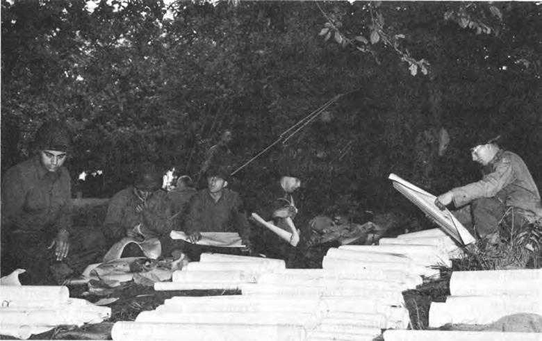
Sorting maps for distribution to men of the 35th Division, St. Lo area, France, July 1944
such fine but essential details as hedgerows threatened to delay completion of the maps until after the Normandy landings, the Intelligence Division reconciled the requirements for timely yet complete representation by backing up each battle map with a photomap of the same area. In April 1944 the Intelligence Division began to receive schedules from ETOUSA for reproduction of maps to support future Allied operations on the Continent. Guided by requisitions averaging 7,500,000 copies per month, AMS and private contractors printed about four out of every ten maps used in the theater. The rest were reproduced by the British, by overseas topographic organizations, and later by the French National Geographic Institute. The first shipment from AMS was ready in July 1944, a month ahead of schedule, and by the following April, this agency had shipped nearly 80,000,000 copies of maps that covered the area from Normandy to Berlin.44
While coordinating mapping activities for the invasion, Loper also reached an understanding on the division of responsibility for strategic intelligence. Like the arrangements in regard to mapping itself, this understanding was not to be rigidly adhered to, but in general British and Americans in the theater were to supply data on northern France and Germany, while the Intelligence
Division, OCE, worked on southern France and Asiatic-Pacific areas. The Intelligence Division had already completed various assignments preparatory to operations in France, including terrain, port, and beach studies. During the summer of 1942 the Beach Erosion Board had made a report on landing areas between Cherbourg and Dunkerque. This report, used as a starting point for more detailed studies which were made in the United Kingdom, described the OMAHA and UTAH beaches where the landings took place. The Beach Erosion Board prepared a similar study on the Mediterranean coast. During 1943, ERO, working from documents from the French Information Center in New York, had finished several reports on France, crowned by four volumes which dealt with inland waterways. Hence the remaining efforts for France were devoted to answering requests for spot information. By the fall of 1944, as the Allies reached the Siegfried Line, ERO had furnished twenty-three volumes on German waterways, bridges, and railway tunnels. For the Rhine crossings, the Intelligence Division investigated the possibility that floods might result from demolition of dams in the Rhineland, provided additional information on the current and condition of the river bed, and prepared “trafficability maps” which showed how weather conditions would affect the advance of tracked or wheeled vehicles over different types of terrain.45
The great distances to terrain objectives in the Pacific made advance field reconnaissance all but impossible, and for many regions intelligence preparations in the United States constituted a primary source of information until aerial photography could be secured. In planning strategy, commanders had to decide what islands were worth seizing and which could be bypassed. The Intelligence Division answered many requests for information about possible locations for airfield sites. If conditions on certain islands made it impossible to develop advance bases, these places would be bypassed in favor of more advantageous sites. Besides indicating the potential military value of many islands, geologists pointed out where construction materials and potable water were to be found. For some of the Japanese mandates, published geological reports were unavailable, but from information on vegetation which grew in these areas, geologists were able to predict the nature of the underlying terrain. Similarly, in the absence of other information, beach erosion experts developed means of determining beach gradients from wave studies.46
After the Teheran Conference in November 1943, the Intelligence Division focused more attention upon operations in the Pacific. MacArthur’s plans for 1944 called for a series of amphibious landings at strategic points on the northern coast of New Guinea and its outlying islands, to culminate in the invasion of the Philippines. During the spring of 1944, the Joints Chiefs of Staff, in consultation with the Engineers, the AAF, and the Navy, issued a directive for the Philippines mapping program. The archipelago was divided into two
topographic zones: one consisting of Mindanao alone, which received first priority because it was then indicated as the first strategic objective, and another, which embraced the remaining islands to the north. Photographic requirements for Mindanao involved a general coverage of 36,000 square miles by trimetrogon photography, supplemented with 7,000 square miles of vertical photography for areas where intensive ground operations were expected.47
Topographic units in the Southwest Pacific had been unable to start remapping the Philippines before August 1944 because photographic aircraft based in New Guinea lacked sufficient range. Accordingly they looked to AMS to prepare the initial supply of maps. Existing coverage at tactical scales for the Philippines, which embrace over 7,000 islands, was confined mainly to the coastal fringes. Most of these charts had been made between 1903 and 1938 by the Navy and the Coast and Geodetic Survey by means of survey boats. The U.S.N. Hydrographic Office furnished AMS with hydrography for 469 sheets covering Luzon, Mindanao, and the Central Philippines. In peacetime the Corps of Engineers had also started to map some of the major islands at tactical scales, but limited funds prevented progress. AMS had some aerial photography of Luzon and the Sulu Archipelago dating from the late thirties. With these materials, AMS prepared to deliver, between August and December 1944, stocks of maps for the area south of 15°, with particular emphasis on Mindanao. Topographic units in the theater would revise these maps as soon as photography became available.48
While preparations for the invasion were proceeding according to plan, naval reconnaissance on 12 September 1944 revealed weakness in the defenses of the Central Philippines. Partly on the basis of this information, the invasion date for Leyte was advanced to 20 October, sixty days ahead of schedule. This abrupt change in strategy created untoward problems in the mapping program. Not until 1 October, when an airfield on Morotai became operative, was it physically possible for land-based photographic aircraft to carry out missions over Leyte. AMS had meanwhile furnished complete coverage of the island with 1:200,000 scale Coast and Geodetic Survey maps, which were fairly accurate along the coast, but which were very defective inland, and with several coastal sheets at 1:50,000 scale. Additional photography for the mountainous regions, where, on the maps, parts of the main supply road and many peaks were misplaced by several thousand yards, could not be obtained until late in the campaign. To remap this sector, where the hardest, most protracted resistance developed, Sixth Army topographers blew up the 1:200,000 scale map to 1:50,000 scale and periodically added information from captured Japanese maps, sketches by patrols, aerial photographs, and other sources.49
For the Luzon campaign, which opened on 9 January 1945, AMS prepared aeronautical charts and a road map of the entire island, and, utilizing Coast and Geodetic Survey material and prewar photography, issued topographic maps at 1:25,000 and 1:50,000 scales. These maps were confined to the landing beach area and the central plain from Lingayen Gulf to Manila. Eighteen tons of maps were shipped by air so as to reach the theater in time for the invasion. The rest—some 300 tons—went by sea. Many of the sheets were old and inaccurate because of changes in culture, vegetation, and stream patterns. As at Leyte, the maps were adequate for the first thirty days of operations, when the Sixth Army rapidly swept over the central plain to Manila. Then, just as before, the rest of the campaign dragged out in the extensive unmapped or poorly mapped mountain regions which the Japanese defended with fanatical tenacity.50 Noting the limitations of the sources with which AMS had to work, Matthews, who succeeded Loper as chief of the Intelligence Division, described the maps supplied for the Philippines as “very poor and somewhat embarrassing.”51
In addition to maps, the Intelligence Division contributed fourteen volumes dealing with landing beaches, ports, roads, and communications of the Philippines, and nine other volumes about the other islands that had been considered for use as intermediate bases. In response to theater requests, the Intelligence Division sent a team of geologists and beach experts to the Southwest Pacific Area in the spring of 1944 and another to the Pacific Ocean Areas that fall. Serving on the staffs of the Chief Engineers, these teams gave valuable assistance in integrating strategic engineering data with information obtained in the theaters.52
Map coverage for Japan consisted of 1,700 sheets, scale 1:50,000, and 1,200 sheets, scale 1:25,000, that had been prepared by the Japanese Imperial Land Survey between 1902 and 1939. The smaller scale maps covered the home islands and extended south to Formosa and north to Siberia. During 1943 and 1944, after romanizing the legends and place names, AMS sent copies of both sets to the Pacific theaters for future reference. For security reasons, the Japanese had shown potential landing places on Kyushu and Honshu as complete blanks on these maps. Comparison with other documentary materials revealed that highway information was also misleading because Japanese maps customarily indicated widths between ditches or right of ways instead of paved surfaces. Other discrepancies appeared, but the Engineers needed aerial photography and geodetic data in order to correct them.53
Some of the most detailed information came from the files of the Japanese Embassy and consulates and those of the Mitsui and Mitsubishi trading companies, which the FBI had seized immediately after Pearl Harbor. Reckoning with the possibility that
these records had been planted for the purpose of misleading American intelligence, the Engineers took precaution to check other sources. ERO contacted exporters of industrial and railroad equipment and investment bankers who had dealt in Japanese securities. Late in 1944 Vogler and three experts from ERO went to Paris to collect information on the Far East. In spite of the handicaps of doing research under wartime conditions, the Vogler team was able to send back a tremendous amount of microfilmed material, including a Japanese encyclopedia and several thousand aerial photographs and accompanying descriptions of the coastline of Indochina. For the translation of data written in Japanese, ERO received inestimable assistance from a Japanese-English technical dictionary which was being compiled by Stanley Gerr under the auspices of the Rockefeller Foundation. The only work of its kind, Gerr’s dictionary contained approximately 130,000 entries, equivalent to several thousand pages of text. In the spring of 1945, after learning how critically this work was needed for research on Japan, the author loaned his manuscript, notes, and card index to ERO without charge.54
By this time, landings on Iwo Jima and Okinawa had brought American forces within 350 miles of Kyushu, southernmost of the main islands of Japan. As the Army and Navy converged upon the enemy’s stronghold, MacArthur and Nimitz prepared to carry out plans for invasion. Photographic aircraft at last could reach Japan and secure coverage needed for revision and original compilation. At the end of May 1945, representatives of the War Department and the various Pacific commands held a conference at Nimitz’ headquarters in Hawaii and formulated a program for photographic and mapping operations. Matthews, who served as chairman of the mapping committee, recommended the establishment of a single agency under MacArthur for coordinating the efforts of AMS and the topographic units scattered throughout the Pacific. Mapping requirements for the projected campaigns included beach areas at 1:10,000 scale, completely new coverage of Kyushu and Honshu at 1:25,000 and 1:50,000, and road maps for the entire archipelago at 1:250,000.55
As a result of the mapping conference, Army Forces in the Pacific requested AMS to reproduce and ship 27,000,000 maps by the first week of July and 33,000,000 more by October. This was by far the biggest order to be produced within such a short time, but with the aid of ninety-five lithographic and seven drafting firms, the deadline was met. The Intelligence Division furnished fourteen volumes on Japanese railroads as well as numerous terrain studies and prepared forty-six additional volumes of strategic information for possible operations on the Chinese mainland. After the surrender of Japan, two months before the projected
invasion, cushion stocks of maps that had been stored on Oahu, Guam, and Luzon were made available for the occupation.56
Time and again World War II experience demonstrated the importance of making advance preparations for supplying maps and strategic Engineer intelligence. The difficulty of furnishing detailed maps and terrain information for overseas theaters that practically spanned the globe proved beyond doubt the shortcomings of earlier concepts based upon wars of limited scope. In one respect only was the Army prepared. Engineer topographic units were equipped with the most modern means of compiling maps from aerial photography. These means were never completely exploited. Like the rest of the Army, the AAF tended at first to emphasize the development of fighting units to the neglect of supporting organizations. By the time photo reconnaissance aviation assumed its proper position in relation to fighting elements it was too late to make the radical changes that full exploitation of aerial photography demanded. But even had reconnaissance aviation not been the stepchild it was, the AAF could not have begun to supply the coverage required during World War II. Thanks in great part to the maps turned over to the United States by the British, the AAF’s task assumed more reasonable proportions. Another significant aid in accomplishing the over-all mapping mission was the trimetrogon system of photography. This method served well in the Pacific where numerous, uncultivated areas, widely separated, had to be covered. In Europe, where trimetrogon photography could not be used, the AAF’s inadequate photographic air craft threatened to cancel out the years spent in perfecting modern methods of map compilation and to interfere seriously with the timely delivery of maps. Both for want of aerial photography and as a result of break-downs in the system of distribution, shortages of maps occasionally did occur in Europe, but in general the right maps were on hand at the right time. The Engineers proved correct in their estimate of the demand for large- as well as small-scale maps. As long as the Army moved rapidly, it had no use for battle maps. In landing operations and in areas where the enemy had established strong defensive positions, there was an insistent call for large-scale, highly detailed maps.57 Realizing that theater units could not supply nearly enough maps for the expeditionary forces, the Corps of Engineers enlisted the aid of civilian agencies and reorganized and strengthened the Army Map Service. Incidental to printing a total of 450,000,000 copies of 44,000 different maps, AMS developed into a complete mapping establishment with a collection that covered all parts of the world.